
Waterfalls appear almost everywhere in British Columbia.
They tumble from alpine lakes, pour through narrow canyons and emerge unexpectedly beside highways and forest trails. Some, such as Takakkaw Falls in Yoho National Park, plunge from cliffs hundreds of metres high. Others descend mountain slopes in a succession of smaller cascades, swelling during spring runoff and shrinking to ribbons later in the year.
Their abundance is no coincidence. British Columbia brings together nearly every ingredient needed to form a waterfall: steep mountains, heavy precipitation, deep winter snowpacks, glaciers and a geologically complicated landscape shaped by uplift, erosion, volcanic activity and moving ice.
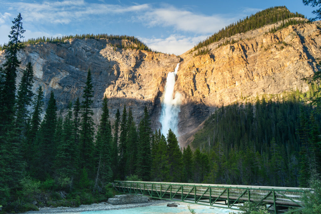 Takakkaw Falls
Photo by iStock
Mountains Put Water In Motion
At its simplest, a waterfall needs flowing water and a sudden change in elevation. British Columbia has plenty of both.
Mountain ranges cover most of the province, including the Coast Mountains, Columbia Mountains and Canadian Rockies. Streams that begin at higher elevations must lose considerable height as they travel toward valley floors, larger rivers and the ocean.
In some places, that descent is gradual. In others, water reaches a cliff, resistant band of rock or steep break in the landscape and drops almost vertically.
BC’s mountains also help produce the water that feeds those streams. Moist air arriving from the Pacific Ocean is forced upward when it encounters the Coast Mountains. As the air rises, it cools and releases moisture as rain or snow – a process known as orographic precipitation.
This helps make BC’s coast and windward mountain slopes some of the wettest parts of Canada. Even during relatively dry periods, water stored in mountain snowfields, glaciers, lakes and saturated forests can continue feeding creeks and rivers.
Glaciers Carved The Drops
Rain and elevation explain why BC has so much moving water, but glaciers are responsible for much of the landscape over which it travels.
During the last ice age, enormous glaciers occupied valleys throughout the province. Ice flowing through major valleys carved deeply into the bedrock, widening and lowering the valley floors. Smaller glaciers in tributary valleys had less erosive power and did not cut as deeply.
When the ice retreated, many of those smaller valleys were left perched above the deeper main valleys. Geologists call them hanging valleys.
Today, streams flowing out of hanging valleys encounter an abrupt edge where the tributary valley meets the main one. The water has nowhere to go but down, creating some of the province’s tallest and most dramatic waterfalls.
Takakkaw Falls is a particularly striking example of a landscape shaped by ice. The falls descend from high above the Yoho Valley, fed by meltwater from the Daly Glacier. The surrounding Canadian Rocky Mountain parks remain classic examples of glacial processes acting on highly folded, faulted and uplifted rock.
Glaciers also left behind steep-sided valleys, cirques, basins and rock steps. Once the ice disappeared, water occupied these features, forming lakes and streams connected by cascades and falls.
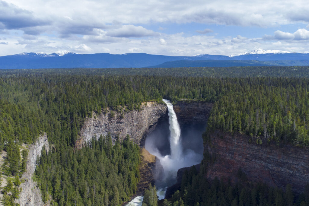 Helmcken Falls
Photo by iStock
Rainfall & Snowmelt Keep Them Flowing
A cliff alone does not make a waterfall. There must also be a reliable source of water – and the character of that source determines how a waterfall changes through the year.
Along the coast, frequent rainfall can keep waterfalls active through much of the year. Atmospheric rivers and winter storms can transform quiet streams into powerful torrents, while smaller seasonal falls may appear on mountainsides after prolonged rain.
In colder and higher regions, snow plays a larger role. Winter precipitation accumulates in the mountains and is released as temperatures rise. During spring and early summer, melting snow fills creeks and rivers, often producing the most impressive waterfall flows of the year.
Glacier-fed falls follow a somewhat different rhythm. Their volume may increase during warm weather as more ice and snow melt. Takakkaw Falls, for example, is generally most powerful during the summer melt season, while access to the falls is seasonal.
This combination of rain, snow and glacial melt means BC’s waterfalls do not all peak at the same time. A coastal waterfall may be most dramatic during the rainy season, while one in the Rockies or Columbia Mountains may reach its greatest volume during late spring or summer.
Rock Determines Where Water Falls
The type and arrangement of rock beneath a stream also influence whether it forms a waterfall.
Some rock layers erode more easily than others. When a river flows over hard, resistant rock resting above softer material, the softer layer may wear away more quickly. This can undercut the harder rock and create a ledge from which the water drops.
Over time, falling water, sediment and freeze-thaw cycles continue eroding the cliff. Pieces of the overhanging rock eventually break away, causing the waterfall to retreat upstream.
Faults and fractures can also create zones of weakness in the bedrock. Erosion may follow these breaks, helping streams carve channels, canyons and abrupt drops. Faulting is not the main explanation for every waterfall in BC, but the province’s complex geological structure helps create the irregular terrain over which its rivers travel.
Volcanic landscapes add another variation. At Helmcken Falls in Wells Gray Provincial Park, the Murtle River plunges over the edge of a broad volcanic plateau into a deep canyon. Layers of ancient lava helped shape the cliff and surrounding landforms, while the force of the water continues to erode the rock below.
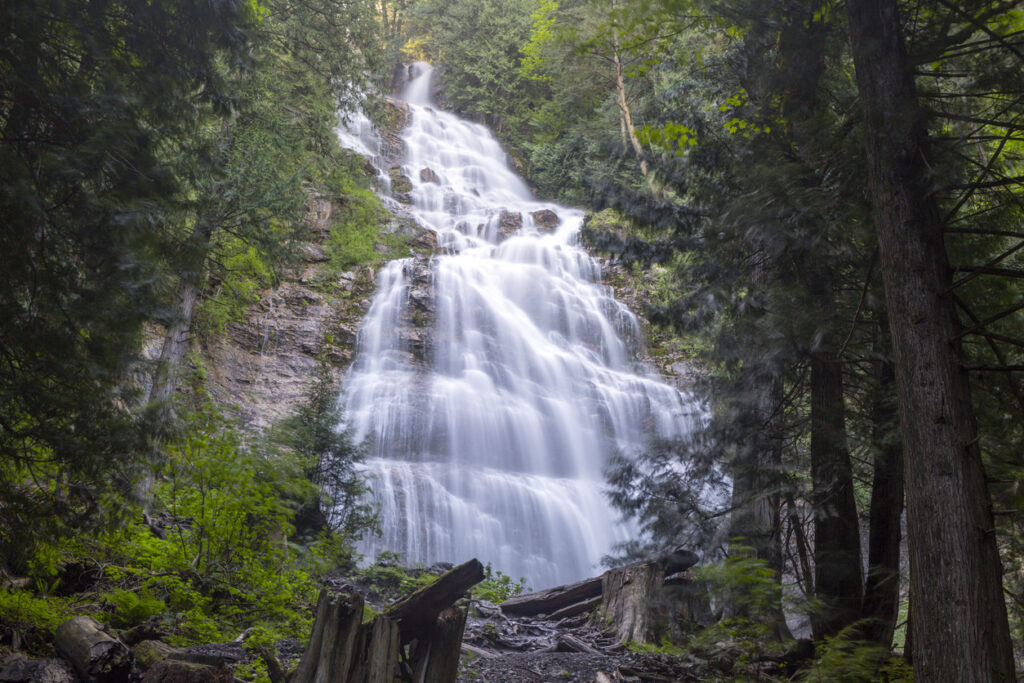 Bridal Veil Falls
Photo by iStock
Waterfalls Are Still Changing
Although many BC waterfalls occupy landforms created thousands or millions of years ago, they are not permanent fixtures.
Water constantly reshapes the rock beneath and behind a waterfall. Floods can move boulders, alter channels and trigger slope failures. Rockfalls can change the shape of a drop almost instantly. Seasonal freezing and thawing widen cracks, while sediment carried by a river scours its bed.
Climate change may also alter the amount and timing of water flowing over some falls. Warmer winters, earlier snowmelt and shrinking glaciers can change seasonal flow patterns, particularly where waterfalls depend heavily on alpine ice and snow.
The result is a landscape that is both ancient and active. BC’s waterfalls reveal the history of mountain building, glaciation and volcanic activity, but they also show erosion taking place in real time.
Every cascade tells a slightly different version of that story. Some owe their height to valleys carved by glaciers. Others follow faults, tumble over resistant rock or drain mountains soaked by Pacific storms. Together, they reflect the combination of water, ice, stone and elevation that has made British Columbia a province of waterfalls.