 Photo: GeoBC map
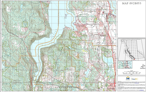
Your old backcountry buddy, the topographical map, has received an upgrade–just in time for Canada day long-weekend adventures.
The provincial government recently announced the release of 7,027 high-resolution digital topographical maps of British Columbia. The maps, which cover the entire province at a scale of 1:20,000, are optimized for viewing on mobile devices. And . . . they’re free!
The maps are also “spatially aware,” able to track the user’s location and movements if the mobile device has GPS capability. (So you’ll know in real-time the exact moment you veer off course.)
PDF files of the “Terrain Resource Information Management” map series can be downloaded from GeoBC’s website and then transferred to a phone or tablet (there’s no app).
A caveat: The folks at BC Search and Rescue Association caution that these digital maps may give outdoorspeople a false sense of security. They recommend bringing back-up paper maps on any outdoor endeavour.
Besides, you can’t use an iphone to get an emergency fire started.
