There is a moment before a winter storm reaches British Columbia’s outer coast when the Pacific seems to change character.
The horizon disappears beneath grey. Wind presses into the forest. Then the first big swells arrive, long lines of water travelling toward shore from storms that may still be hundreds or even thousands of kilometres away.
On exposed headlands, those swells meet rock with a concussion you can feel. Spray rises above islands. Beaches shrink beneath advancing water. Driftwood that seemed immovable suddenly does not.
This is storm-watching season on the BC coast, and to appreciate it safely, it helps to understand what you are actually watching.
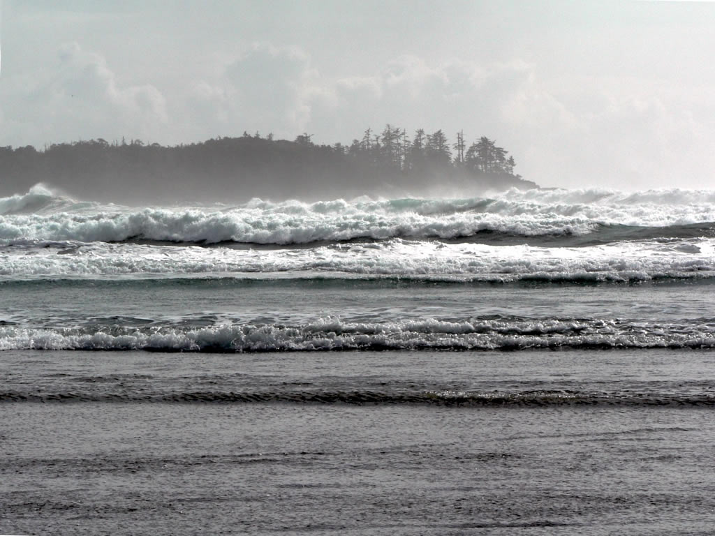 Photo by Flickr/David Stanley
Where The Big Waves Come From
Most ocean waves begin with wind transferring energy to the water. Their size depends largely on how strongly the wind blows, how long it blows and the fetch, or distance of open water over which it travels.
British Columbia’s outer coast has plenty of ocean in front of it.
Storms crossing the North Pacific generate waves that can eventually outrun the weather that produced them. As they travel, they organize into smoother, longer-period swells capable of crossing thousands of kilometres. That is why heavy surf can arrive before local wind and rain become especially dramatic.
As those swells reach shallow water, they slow, steepen and break. Reefs, headlands and underwater topography can focus or disperse that energy, which is why nearby beaches can behave very differently during the same storm.
Marine forecasts also require some interpretation. Environment and Climate Change Canada reports significant wave height — the average height of the highest one-third of waves — not the height of every wave. Individual waves can be substantially larger.
A forecast for four-metre seas does not mean every wave will be four metres.
Storm, Swell & Tide
The most dramatic conditions happen when several factors overlap.
Fall and winter bring frequent Pacific low-pressure systems to the coast, and Parks Canada identifies November through March as the most dramatic storm-watching period in Pacific Rim National Park Reserve.
Some systems also carry atmospheric rivers, long corridors of moisture that can produce intense rain when they encounter BC’s mountains. But heavy rain and big swell are not necessarily the same event. Large surf can arrive when local weather seems relatively calm.
Tide matters too.
Storm-driven water levels can combine with high tide, allowing waves to reach much farther up beaches and rocky shorelines than visitors may expect.
A beach that feels spacious on a calm summer afternoon can become an entirely different place during winter swell.
The Wave You Didn’t Expect
Storm watching becomes dangerous when people assume waves arrive in a predictable pattern.
They do not.
Larger waves can arrive after several smaller ones and run much farther up a beach. On BC’s coast, piles of driftwood add another hazard. Logs that look immovable can float and roll when hit by heavy surf.
The simplest rule is also the most useful: the best viewpoint is not the closest viewpoint.
Stay off tidal rocks. Keep away from driftwood when surf is active. Face the ocean. Obey closures and warning signs. And when an elevated viewpoint is available, use it.
BC has several places where the coast puts on a spectacular show without requiring visitors to stand in the surf zone.
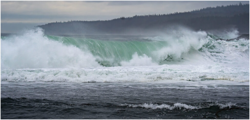 Photo by Flickr/marneejill
Ucluelet: Rocky-Coast Theatre
If Tofino is famous for beaches, Ucluelet makes the case for rocks.
The Wild Pacific Trail follows a coastline of reefs, surge channels, offshore islands and wind-shaped forest. During heavy swell, waves collide with that geology in spectacular fashion while established viewpoints keep visitors back from the most exposed shoreline.
The Lighthouse Loop around Amphitrite Point is the classic introduction. Stay on the trail rather than scrambling onto the coastal rocks. The Wild Pacific Trail Society warns storm watchers to respect closures and avoid following others onto exposed rock.
Farther along, the Artist Loops include a dedicated storm-watching deck and several ocean overlooks.
Ucluelet is especially good for seeing how shoreline shape transforms waves, with swell wrapping around islands and exploding against reefs and headlands.
Pacific Rim National Park Reserve: Watch From Above
Between Ucluelet and Tofino, Pacific Rim National Park Reserve combines open-ocean exposure with purpose-built viewing.
Parks Canada recommends the Kʷisitis Visitor Centre observation deck at Wickaninnish Beach and the Florencia Bay Lookout as safer places to watch large waves.
At Florencia Bay, an elevated platform overlooks incoming swell. At Wickaninnish Beach, the observation deck offers a broad view of waves breaking across the shoreline without requiring visitors to walk onto the beach.
Long Beach can also be magnificent in rough weather, but conditions matter. Parks Canada advises staying off beaches when tide or swell is high and checking tide tables, swell forecasts and posted wave-hazard information.
South Beach can be particularly dangerous in large surf because of strong currents and unusually powerful waves.
On the biggest days, getting closer rarely improves the experience.
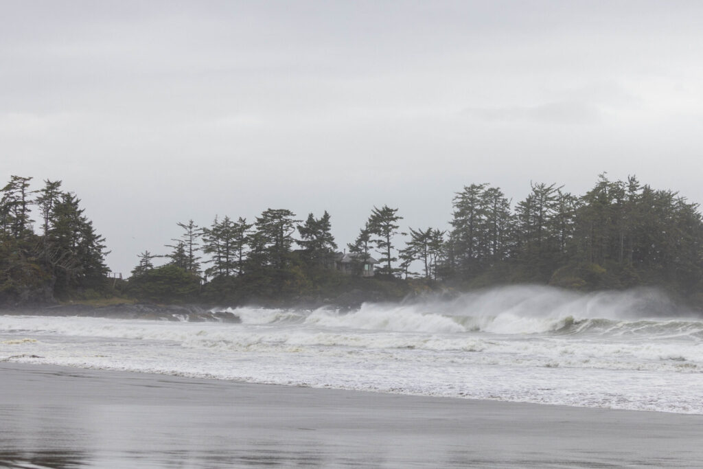 Photo by Flickr/Se Mo
Tofino: Big Beaches, Big Surf
Tofino has become almost synonymous with winter storm watching.
Cox Bay, Chesterman Beach and the northern reaches of the Long Beach area all face the Pacific, but each responds differently to incoming swell.
At Cox Bay, waves breaking around Pettinger Point can throw huge plumes of spray into the air. At North Chesterman Beach, rocky headlands add to the spectacle.
But “storm watching in Tofino” should not automatically mean standing on the beach during the height of a storm.
There are no lifeguards on Tofino or Pacific Rim National Park Reserve beaches. Access points may close during high winds, high tides or storm surge, and visitors should stay off tidal rocks and away from driftwood.
Sometimes the best storm watching is through a window, with the Pacific raging outside.
Port Renfrew: Where The Island Turns Wild
Farther south, Port Renfrew offers another face of Pacific weather.
Here, Juan de Fuca Strait meets the exposed southwest coast of Vancouver Island, and winter storms can transform scenic shorelines into landscapes of spray and breaking surf.
Botanical Beach is well known for dramatic coastal scenery, but rough-weather visits require caution. Its intertidal rock shelves are not the place to stand during heavy swell, even if they appear accessible.
For the roughest conditions, choose elevated or sheltered viewpoints rather than the water’s edge.
Winter Harbour: The Remote Option
Winter Harbour, on northern Vancouver Island’s Quatsino Sound, offers a quieter and more remote storm-watching experience.
Nearby Hecht Beach faces the open Pacific, while the Botel Park Trail provides ocean views from the community.
The remoteness is part of the appeal, but it also demands preparation. Road access includes gravel logging roads, and cell service can be limited. Carry extra food and water, a spare tire and downloaded directions, and be willing to change plans if conditions deteriorate.
Here, safe storm watching starts before you reach the coast.
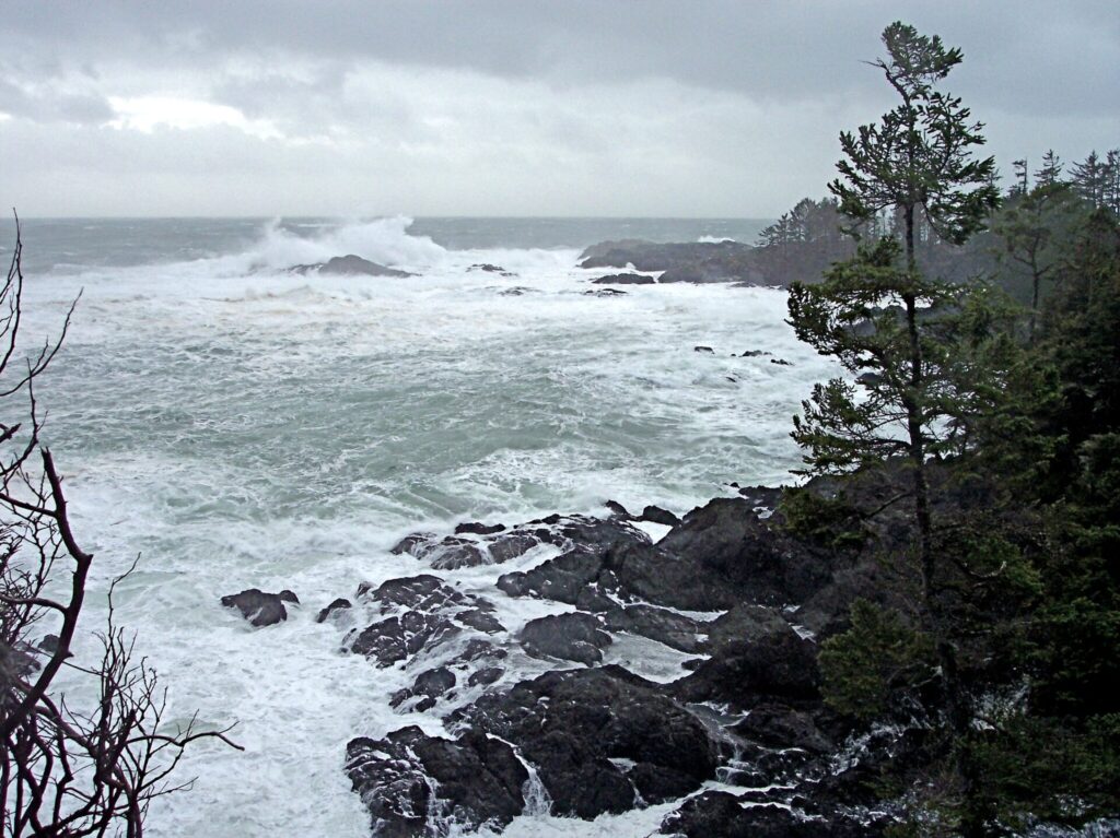 Photo by Flickr/CC BY 2.0
Haida Gwaii: Storms At The Edge Of The Pacific
Few places show BC’s exposure to the North Pacific more dramatically than Haida Gwaii.
Parks Canada describes the west coast of Gwaii Haanas as one of Canada’s wettest and windiest regions, regularly struck by storms crossing the open ocean.
Visitors do not need to venture into that remote coastline to see the sea at work.
At the northern end of Graham Island, Taaw Tldáaw | Tow Hill and the North Beach area offer road-accessible Pacific scenery. A boardwalk trail leads to a viewing platform at Kwahtsiisda, the Blowhole, providing a much safer option than wandering onto wave-washed rock.
Weather changes quickly on Haida Gwaii, and strong winter systems can disrupt travel. Flexibility is part of the experience.
Sometimes the safest choice is simply to wait.
How To Read A Storm-Watching Forecast
Before heading out, check four things.
Weather warnings: Look for strong winds, heavy rain and special weather statements.
Marine forecasts: Pay attention to wave height and remember that the largest individual waves can exceed the reported significant wave height.
Tides: High tide leaves less beach between you and the surf.
Local closures: Parks and communities may close beaches, trails or access points because of windfall, flooding or extreme surf.
Then check conditions again when you arrive.
The ocean in front of you outranks the forecast on your phone.
The Best Seat Is The Safe One
There is something wonderfully counterintuitive about travelling to the coast because the weather is terrible.
Winter strips away the postcard version of the Pacific. The sea becomes muscular and loud. Forests bend. Beaches rearrange themselves. Swell generated far beyond the horizon arrives carrying the energy of weather most of us never saw.
That is precisely why storm watching works best when it remains watching.
Choose the lookout over the rock ledge. Choose the trail over the driftwood. When the sea begins reaching places where it normally does not, move farther back rather than closer.
The Pacific will provide all the drama you need.
You just have to give it room.