1. Sidney Spit
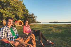 Sidney Spit
Much of what makes Gulf Islands National Park special is only accessible from the water, and that includes this park and campground at the north end of Sidney Island. Luckily for this special spot, you don’t need your own boat to access it. A passenger ferry from the town of Sidney on southern Vancouver Island shuttles back and forth four times a day. Once on the island, you can hike around the Lagoon Trail and pick out dozens of water birds that flock here, beach-comb for hours on the almost endless sand beach or check the tide pools for treasures at low tide. If you’re looking for ma longer stay, you can set up in one of the 29 campsites a short walk from the dock, many looking out from the forest across the beach grass and onto the ocean.
– Ryan Stuart
2. Lighthouse Loop
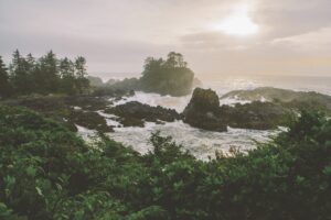 Lighthouse Loop
This 2.6-kilometre stroll meanders through the lush moss-covered rainforest nestling up to the rugged coastline and rocky headlands of the Ucluelet Peninsula. The Lighthouse Trail, part of the larger Wild Pacific Trail, boasts views of Barkley Sound and the powerful waves crashing below.
After the shipwreck of the Pass of Melfort, the Amphitrite Lighthouse was erected in 1906. The replacement, built in 1915, still stands against the wind, watching over the waters and the Broken Group Islands. Walking clockwise, you will see the lighthouse first, followed by two stunning lookout points, Inspiration Point and He-Tin- Kis Beach, nearing the end of the loop. Sit back and enjoy the view from one of the many trail-side benches; you just might see otters, sea lions, seals, whales or hundreds of other species migrating through.
The Lighthouse Loop is best accessed from the first parking lot, midway on Coast Guard Road, nearing the tip of the peninsula. For an extended interactive walk, try the connecting Terrace Beach Interpretive Trail branching from an ancient First Nations’ canoe beach and the BOG Woodland Interpretive Loop (unlike the Lighthouse Loop, this trail is not wheelchair accessible).
– Erin Jackson
3. Cathedral Grove
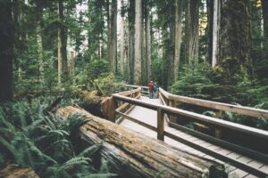 Cathedral Grove
Cathedral Grove, located in MacMillan Provincial Park on Vancouver Island, is one of the most accessible stands of giant Douglas-fir trees in the province, and the towering giants are sure to inspire awe: the largest trees in the park are 800 years old and 250 feet tall. Other species in the park include western redcedar, bigleaf maple, western hemlock and grand fir, making this a nature-lover’s paradise.
The park straddles Highway 4 and you’ll find the largest Douglas-firs on the south side of the highway including one that measures more than 29 feet in circumference. A trail system meanders through the trees and you can spend an hour admiring their majestic beauty as you amble through the forest. You’ll drive through Cathedral Grove on your way to Tofino or Ucluelet and it’s the perfect place to build stoke for your West Coast adventure.
– Sam Burkhart
4. Judges Route
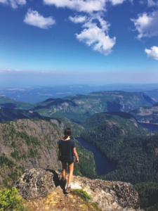 Judges Route
One of central Vancouver Island’s most iconic hikes/scrambles—set on one of its most iconic massifs—Mount Arrowsmith’s Judges Route is at its best in late-summer and early autumn, thanks to dry weather, reduced crowds and very little snowpack (or none at all). Access the route via a rough dirt road off Highway 4 on the way to Port Alberni. Most vehicles capable of a little dirt-driving can get to the trailhead but all-wheel-drive helps.
The well-marked trail carves through subalpine evergreens, passing wide vistas of the Beaufort Range from The Saddle as it enters the alpine, at which time it becomes a scramble—three points of contact may be necessary as you traverse The Knuckles. Some choose to turn around here, others summit the peak via this moderately technical rock-route, culminating at The Nose. Enjoy a sweeping view of the Strait of Georgia to the east and all the way northwest to Strathcona Provincial Park before heading down; you’ll be back at your car five to six hours after you started. (Pack plenty of H2O—you won’t find any accessible water on this route.)
– David Webb
5. Elk Falls Provincial Park
 Elk Falls Park
For years, the Elk Falls viewpoint didn’t do the site justice. Just upriver from its namesake town, the Campbell River plunges 25 metres into a pool surrounded by cliffs and then careens down a 70-metre-deep canyon. The only view of this stunning falls was from the side, through trees.
That is until BC Hydro announced plans to update their generating station just downstream. Construction required the creation of a temporary parking lot, perfectly positioned to access a trail leading through old growth forest to the suspension bridge. When the Rotary Club heard of the plan, they decided to build a 61-metre suspension bridge and two viewing platforms—one wheelchair accessible and one in spray-range of the falls.
Free to the public, the 1.2-kilometre hike to the suspension bridge takes about 30 minutes and is perfect for families. Spend a little more time and enjoy the amazing views of Elk Falls from the lower viewing platform and cross the 60-metre bridge for a view into Elk Falls Canyon and the river below.
– Ryan Stuart
6. Kinsol Trestle
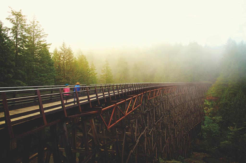 Kinsol Trestle
Forty-four metres above the Koksilah River in Vancouver Island’s Cowichan Valley, the 187-metre-long Kinsol Trestle is one of the tallest free-standing timber rail trestle structures in the world. Long-time fans of the Cowichan Valley trails, we love cycling the backcountry network, and the opening of the Kinsol in 2011 meant that it was now possible to cycle the 48 kilometres from Shawnigan Lake in the south to Cowichan Lake in the north. Today we decide to take the shorter trip and stroll the 1.2 kilometres from the parking lot to the trestle. Once there, we ogle this awesome symbol of human endeavour and take our packed lunch down to one of the several picnic tables, with toilets and a mounting platform for equestrians.
To get there from Victoria, head north on the Trans-Canada Highway to the Shawnigan Lake/Cobble Hill Road just past Mill Bay. Take the road to the intersection at Shawnigan Lake and turn right. Shortly afterward, turn left onto Renfrew Road and turn right onto Glen Eagles Road. A small parking area on the right with the entrance to the Cowichan Valley Trail will soon appear. The trestle is 1.2 kilometres along the path.
– Cherie Thiessen
