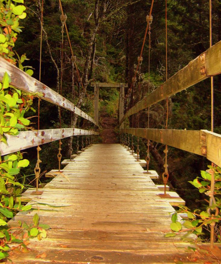
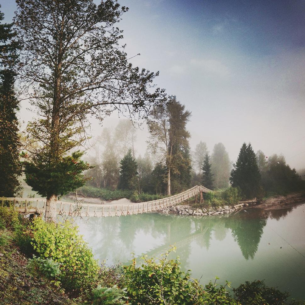
Suspension bridges, they’re polarizing; you love them or hate them. Visitors seem to either hop joyously along their span – encouraging walkways to bounce about – while others make haste across them. With such varied terrain and rivers spanning the province, suspension bridges are often built out of sheer necessity. Gorges that simply can not be traversed with alternative designs see these graceful arcs drawn across two anchors. Here we recount some of our favourite B.C. suspension bridges, from past to present. Some early ones have since been demolished, others zip us across the creeks of epic wilderness pursuits, and iconic ones are part of our daily commute. Oh, and at least one on this list has collapsed…Enjoy!
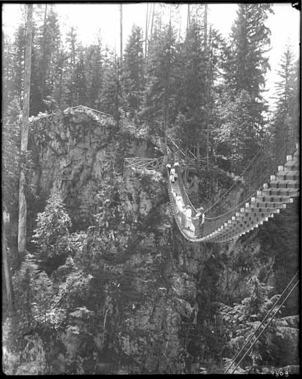
Alexandra Bridge (Trutch’s)
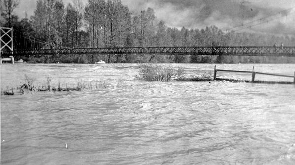
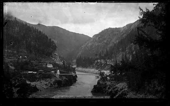 Credit: Vancouver Public Library Special Collections Historical Photographs
Location: Spuzzum
Date erected: 1863
Status: Removed in 1912, replaced by the Second Alexandra
Main span: 82 metres (269 feet)
History: The bridge was originally constructed in 1861 by Joseph Trutch, who worked as the Commissioner of Public Works for the Colony of British Columbia. The bridge was part of the Cariboo Road development. Royal Engineers rebuilt the bridge as the road construction progressed, and a new span opened in 1863. It had fallen into disuse by 1884 and in 1904, most of the bridge was destroyed in a flood. The remains were dismantled in 1912.
Use: Vehicular
Main cables: Wire/iron
Read more about this bridge: historicplaces.ca
Alexandra Bridge (Second)
 Credit: https://www.flickr.com/photos/peterisnuksa/
Location: Spuzzum
Date erected: 1926
Status: In use, but now restricted to foot traffic
Span: 82 metres (270 feet)
History: This bridge is still in use today, but in 1964 the government reduced its use to foot traffic only.
Use: Vehicular, one lane
Main cables: Wire/steel
Read more about this bridge: gov.bc.ca/bcparks/explore/parkpgs/alexandra/
Footbridge
Location: Near Ryan, over the Moyie River (54 km south of Cranbrook)
Date erected: Unknown
Status: In use
History: Unknown
Use: Footbridge
Main cables: Wire
Main span: 1
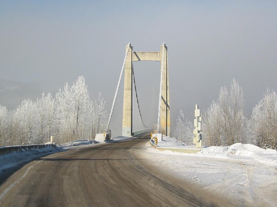
Hagwilget Bridge
 Credit: https://www.flickr.com/photos/bcgovphotos/
Location: Hagwilget Canyon on the Bulkley River (near New Hazelton)
Date erected: 1912
Status: This bridge was replaced in 1931, and the replacement bridge is still open today.
Span: 140 metres (451 feet)
History: The current bridge spans the same location as the original, and it was reinforced again in 1990. It sits 80 metres above the Bulkley River.
Use: Vehicular, one lane
Main cables: Wire/steel
Suspended span: 1
Deck width: 4.9 metres
Read more about this bridge: rdks.bc.ca/hagwilget-bridge
Murray River
Location: Monkman Provincial Park, south of Tumbler Ridge
Date erected: Unknown
Status: In use
History: The suspension bridge allows hikers walking the Monkman Lake Trail to cross the Murray River and continue their adventures into the park’s interior.
Use: Footbridge
Read more about Monkman Provincial Park and this bridge: Click here
Brilliant Suspension Bridge
 Credit: https://www.flickr.com/photos/21953562@N07/
Location: Castlegar area, just upstream from the confluence of the Columbia and Kootenay Rivers
Date erected: 1913
Status: Derelict
Span: 100 metres (331 feet)
History: The bridge was originally used to connect Brilliant, the business and industrial hub of a recently established Doukhobor community, with its agricultural property and other villages on the other side. Although a Vancouver firm oversaw the design and construction, the bridge itself was built by Doukhobor working crews using traditional hand tools and techniques. The Doukhobor community paid for two-thirds of the bridge, with the provincial government contributing the rest. The bridge was closed in the late 1960s, when it was replaced by a more modern version. The Brilliant Suspension Bridge recently received its status as a Canadian National Heritage Site.
Use: Vehicular, one lane
Main cables: Wire/steel
Deck width: 4.8 metres (16 feet)
Read more about historic Brilliant Bridge: usccdoukhobors.org/brilliantbridge
Haslam Creek
Location: Nanaimo area
Date erected: 2002
Status: In use
History: As part of the Trans Canada Trail, this suspension bridge allows hikers to cross over Haslam Creek. A final bridge to cross over the Nanaimo River is still under construction.
Use: Footbridge
Read more about the bridge and trail here: Click here
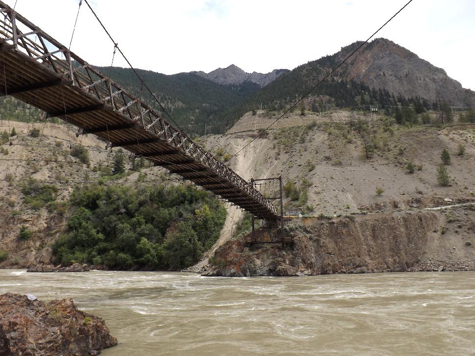
Churn Creek Bridge
 Credit: https://www.flickr.com/photos/tjflex/
Location: Gang Ranch (West Chilcotin – two hours drive from Williams Lake)
Date erected: 1914
Status: In use, last checked in 2006
History: The Churn Creek bridge runs over the Fraser River and is located on Gang Ranch, a working ranch that was established in the early 1860s. At its peak, Gang Ranch was as large as four million acres, including leased lands. At the time, it was largest working cattle ranch in BC. There is a public road that runs through the property and across the bridge now, but the ranch is still in full operation.
Use: Vehicular, one lane
Main cables: Wire/steel
Read more about this bridge: Click here
The Old Bridge
 Credit: https://www.flickr.com/photos/woodhead/
Location: Lillooet
Date erected: 1911-1913
Status: Extant
Span: Approx 120 metres (400 feet)
History: The Old Bridge was built to replace a reaction ferry – a type of cable ferry that was powered by the river current. This type of transportation across the river had been in use since 1860.
Use: Vehicular, one lane
Main cables: Wire/steel
Read more about this bridge: Click here
Birkenhead River
Location: Pemberton area
Date erected: Unknown
Status: In use
History: The suspension bridge is located just past Mt. Currie and spans the Birkenhead River.
Use: Footbridge
Lions Gate
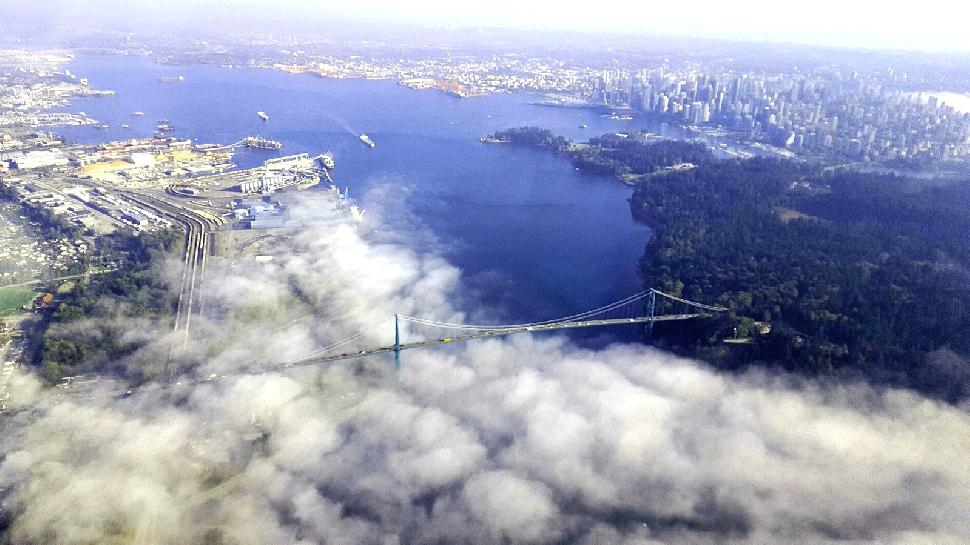 Credit: Jennifer Lee Gunson
Location: Vancouver
Date erected: 1939
Status: In use
Span: 473 metres (1,550 feet)
History: The Lions Gate Bridge crosses the first narrows of Burrard Inlet and connects the city of Vancouver to North and West Vancouver. Northbound traffic on the bridge gets a good view of The Lions, a pair of mountain peaks north of the city – this is where the name “Lions Gate” comes from. The bridge was designated as a National Historic Site of Canada in March 2005.
Use: Vehicular, major highway (3 lane)
Main cables: Wire/steel
Suspended span: 3
Read more about the Lion’s Gate Bridge: Click here
Kelowna Mountain Vineyards & Bridges
Location: Kelowna
Date erected: Park purchased and developed in 2003
Status: In use
History: The Kelowna Mountain Vineyards & Bridges is a privately owned park and four suspension bridges cross over the vineyards. One of these bridges is the longest in North America.
Use: Footbridge
Span: The Earth Bridge spans 400 feet; the Sun Bridge sits 100 feet over an ice wine vineyard; the Water Bridge is 800 feet long; the Vine Bridge finishes at a koi fish pond and outdoor amphitheatre.
Top Bridge Trail
Location: Parksville, over the Englishman River
Date erected: Unknown
Status: In use
Span: 81 metres (265 feet)
History: This suspension bridge was erected along the Top Bridge Trail, as a way for visitors to cross over the Englishman River gorge and continue touring the area. This is considered one of Parksville’s secret gems.
Use: Footbridge
Read more about this bridge: Click here
Peace River Bridge
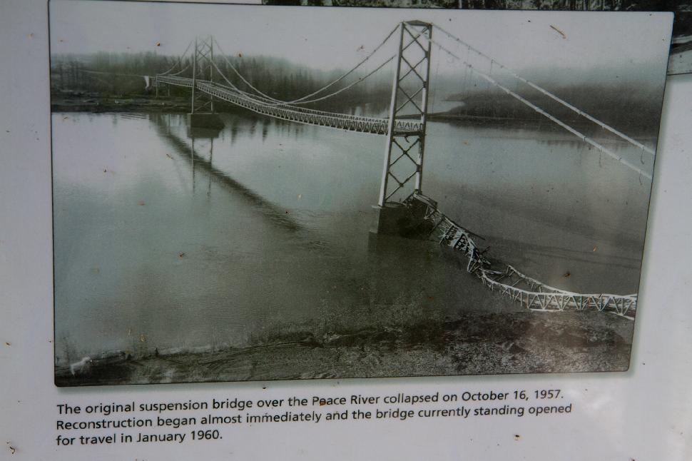 Credit: https://www.flickr.com/photos/arthurtlabar/
Location: Taylor
Date erected: 1943
Status: Demolished
Span: 609 metres (2,000 feet)
History: The Peace River Suspension Bridge was opened in 1943 and collapsed on Oct. 16, 1957. There were no injuries or fatalities that occurred as part of the collapse. When the bridge opened, it was the longest bridge on the Alaska Highway. The Peace River Bridge has since replaced this suspension bridge.
Use: Vehicular
Main cables: Wire/steel
Suspended span: 3
Read more about the collapse: Click here
Loss Creek
Location: Juan de Fuca Marine Trail, over Loss Creel
Date erected: Unknown
Status: In use
History: There are a few suspension bridges along the Juan de Fuca Marine Trail. The trail stretches 47 kilometres along Vancouver Island’s western coast.
Use: Footbridge
Lower Liard River
 Credit: “Liard River Bridge, BC” by JERRYE AND ROY KLOTZ MD – Own work. Licensed under CC BY-SA 3.0 via Commons
Location: Near the Liard River Hot Springs, along the Alaska Highway
Date erected: 1943
Status: In use, heavy
Span: 307 metres (1,007 feet)
History: The Lower Liard River Suspension Bridge is the only suspension bridge along the Alaska Highway. At the time of construction, engineers decided to build a suspension bridge because ice conditions made it impossible to keep the temporary scaffolding in place for a long enough period of time to complete a traditional truss span design.
Use: Vehicular, two lanes
Main cables: Wire/steel
Suspended span: 3
Read more about this bridge: ouralaskahighway.com/lower-liard-river-bridge
Sheep Creek Bridge
Location: Williams Lake area
Date erected: Unknown
Status: Removed
History: Where the Sheep Creek Bridge now resides, there used to be a suspension bridge instead.
Use: Vehicular, one lane
Main cables: Wire/steel
Suspension bridge at Bella Coola
 Credit: Bella Coola Valley Museum – Photograph Collection
Location: Bella Coola
Date erected: 1932
Status: Removed
History: This small suspension bridge is accessed along Burnt Bridge Creek. The original 1932 bridge was removed and replaced with a newer suspension bridge in 1957.
Use: Foot traffic
Main cables: Wire
Read more about this bridge: Click here
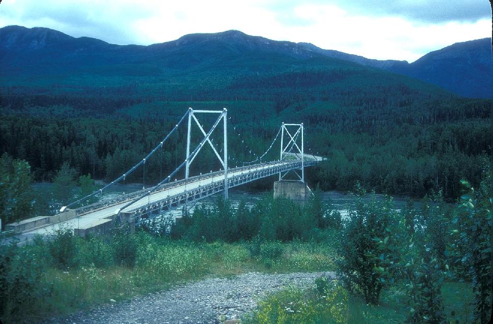
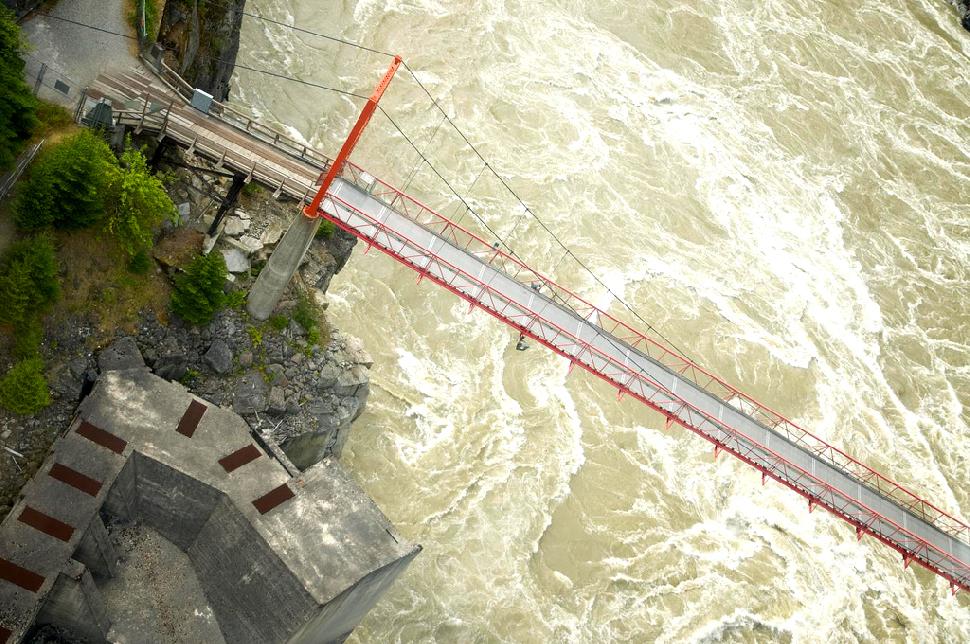
Hudson’s Hope Suspension Bridge
 Credit: https://www.flickr.com/photos/tranbc/
Location: Hudson’s Hope
Date erected: 1965
Status: In use
Span: 220 metres (721 feet)
History: Highway 29 crosses the Peace River via the Hudson’s Hope Suspension Bridge.
Use: Vehicular, two-lane heavy traffic
Main cables: Wire/steel
Suspended span: 1
Read more about this bridge: Click here
Koksilah River
Location: Cowichan Station, Bright Angel Provincial Park
Date erected: Unknown
Status: In use
History: Bright Angel Provincial Park is 4.13 hectares of land that was donated to the government by Jack and Mabel Fleetwood. Jack strongly believed in guardian angels, and the park was named after that ideal. The suspension bridge was constructed over the Koksilah River.
Use: Footbridge
Main cables: Wire/steel
Gitwinksihlkw
 Credit: https://www.flickr.com/photos/thepha/
Location: Gitwinksihlkw (Canyon City, 105 km north of Terrace)
Date erected: 1968
Status: In use
Span: 339 feet
History: The Nisga’a Village of Gitwinksihlkw has had a suspension bridge over the Nass River for more than 400 years. The current bridge is over a metre wide, and although there is a traditional road bridge into the village, the suspension bridge has been fully restored and serves as a tourist destination for locals and visitors crossing the Nass River.
Use: Footbridge
Main cables: Wire/steel
Suspended span: 1
Read more about this bridge: nisgaanation.ca/suspension-bridge
Cheewhat River
Location: West Coast Trail
Date erected: 1976
Status: In use
History: This wooden suspension bridge is a highlight for hikers taking on the West Coast Trail.
Use: Footbridge
Main cables: Wire
Suspended span: 1
Similkameen Ore Conveyor Bridge
Location: Princeton
Date erected: 1980
Status: In use
Span: 403 metres (1,325 feet)
History: The highest bridge ever built in Canada, standing at 570 feet, the Similkameen Ore Conveyor was erected as part of the Similco copper mining company just outside Princeton. As much as 1,600 tons of ore can cross the conveyor in an hour.
Use: Conveyor
Main cables: Wire/steel
Read more about this bridge: Click here
Zuckerberg Island Heritage Park
 https://www.flickr.com/photos/kylewlane/
Location: Castlegar
Date erected: 1984
Status: In use
Main span: 91 metres (300 feet)
History: Built in the Zuckerberg Island Heritage Park, the suspension bridge was developed as a field exercise for the 44th Field Engineering Squadron and was allowed to remain as a connection to the island. The bridge won the Canadian Militia Herztberg Award and all of the materials to build the bridge were donated.
Use: Footbridge
Main cables: Wire/steel
Suspended span: 1
Deck width: 1 metre (3 feet)
Read more about Zuckerberg Island: stationmuseum.ca/zuckerberg
Hanging bridge over Tsocowis Creek
 https://www.flickr.com/photos/ndanger/
Location: Tsocowis Creek, West Coast Trail
Date erected: Unknown
Status: In use
History: Constructed as part of the West Coast Trail. Online reports say the bridge is a neat feature of the trail, but climbing up the ladders to get on and off the bridge is a bit scary.
Use: Footbridge
Main cables: Wire
Elk Falls Suspension Bridge
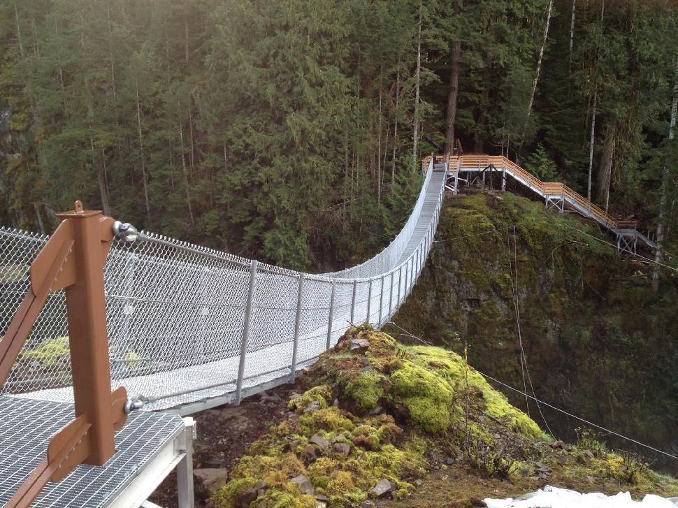 Credit: Tourism Campbell River
Location: Campbell River area, over Elk Falls Canyon
Date erected: Opened May 2015
Status: In use
Span: 64 metres (209 feet)
History: The bridge was a joint project between BC Parks, BC Hydro, the Campbell River Rotary Club, the local government and the BC government as a way to get more visitors to Elk Falls and make the park accessible for more people.
Use: Footbridge
Read more about this bridge: gocampbellriver.com/elk-falls-suspension-bridge
Footbridge
Location: West Creston area, along the Dewdney Trail
Date erected: Unknown
Status: In use
History: The suspension bridge was constructed as a way for hikers to get over Summit Creek, while taking the Dewdney Trail.
Use: Footbridge
Read more about Dewdney Trail: Click here
Crazy Creek Waterfalls Bridge
Location: West of Revelstoke
Date erected: Unknown
Status: In use
Span: 73 metres (240 feet)
History: This suspension bridge was built in front of the Crazy Creek waterfalls for optimum viewing opportunities. There are also boardwalks and viewing platforms for the falls.
Use: Footbridge
Read more about this bridge: Click here
Malakwa Suspension Bridge
 https://www.flickr.com/photos/urbanworkbench/
Location: Revelstoke
Date erected: 1915
Status: In use
History: The bridge was built as a way for farmers to cross Eagle River to the nearest community and school. It was rebuilt in 1940.
Use: Footbridge
Read more about this bridge: Click here
Capilano Suspension Bridge
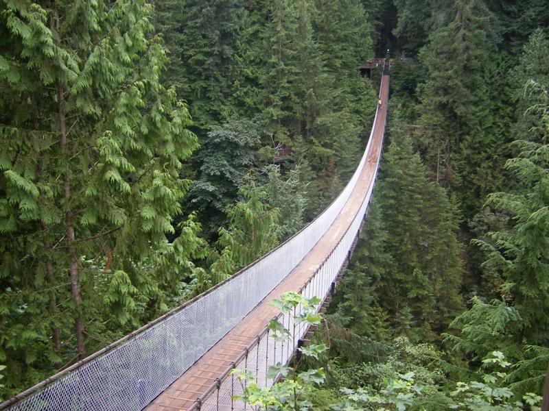 Credit: https://www.flickr.com/photos/maryandjc/
Location: North Vancouver
Date erected: 1889
Status: In use
Span: 137 metres (450 feet)
History: The Capilano Suspension Bridge Park is a popular attraction in Vancouver, taking visitors through the west coast rainforest. The bridge runs 230 feet above the Capilano River.
Use: Footbridge
Read more about this bridge: capbridge.com
Paint Pots Bridge
Location: Kootenay National Park, over Vermillion River
Date erected: Unknown
Status: In use
History: The original bridge was lost in a flood in 2012. The government installed this bridge as a means for visitors to access the rest of the park and hiking areas.
Use: Footbridge
Main cables: Wire
Hells Gate Suspension Bridge
 Credit: https://www.flickr.com/photos/narrowfocus/
Location: 10 km south of Boston Bar
Date erected: Unknown
Status: In use
Span: 82 metres (270 feet)
History: The suspension bridge was built as a way for tourists to cross the Hells Gate gorge, which is the narrowest point of the Fraser River. At high water, over 200 million gallons of water flow through the gorge per minute.
Use: Footbridge
Main cables: Wire/steel
Suspended span: 1
Read more about this bridge: Click here
Menzies Creek Swinging Bridge
Location: Campbell River area
Date erected: New bridge put up in 2014
Status: In use
History: The bridge is part of the Ripple Rock Trail and crosses Menzies Creek. It was replaced in 2014 and the trail was resurfaced.
Use: Footbridge
Main cables: Wire/steel
Lynn Canyon Suspension Bridge
Location: Lynn Canyon Park, North Vancouver
Date erected: 1912
Status: In use
Span: 40 metres (131 feet)
History: This 50-metre-high bridge stretches across Lynn Canyon’s raging waters, waterfalls and pools. The bridge is a popular destination, but it can be nerve-wracking to cross!
Use: Footbridge
Website: lynncanyon.ca/tour/suspension-bridge
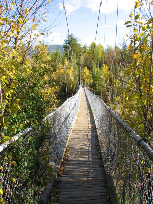
 Lynn Canyon Suspension Bridge in North Vancouver
Logan Creek
Location: West Coast Trail
Date erected: Unknown
Status: In use
Span: 100 metres (328 feet)
History: The suspension bridge crossing Logan Creek is part of the West Coast Trail – one of the more rugged parts. According to hiker testimonial online, the suspension bridge (and the ladder to get down to it) is not for the faint of heart.
Use: Footbridge
Yukon Suspension Bridge
Location: South Klondike Highway, northern BC, White Pass summit
Date erected: 2006
Status: In use
Span: 60 metres (200 feet)
History: The bridge crosses over the Tutshi River and canyon and serves as an amazing look out point to the surrounding area.
Use: Footbridge
Read more about this bridge: Click here
Sky Pilot Suspension Bridge
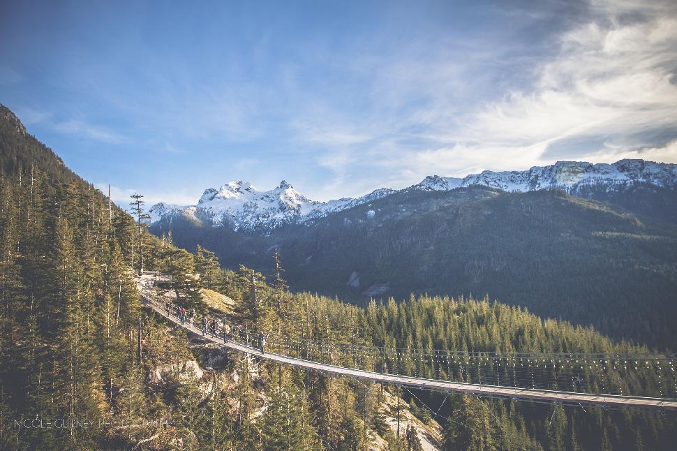 Credit: (c) Nicole Gurney Photography via seatoskygondola.com
Location: Sea to Sky Gondola, Squamish
Date erected: 2013
Status: In use
Main span: 110 metres (360 feet)
History: The suspension bridge was created as part of the Sea to Sky Gondola project near Squamish. The bridge will link parts of the project together and will give tourists a 360-degree view of Howe Sound.
Use: Footbridge
Website: seatoskygondola.com/suspension-bridge
Metlakatla Wilderness Trail Bridges
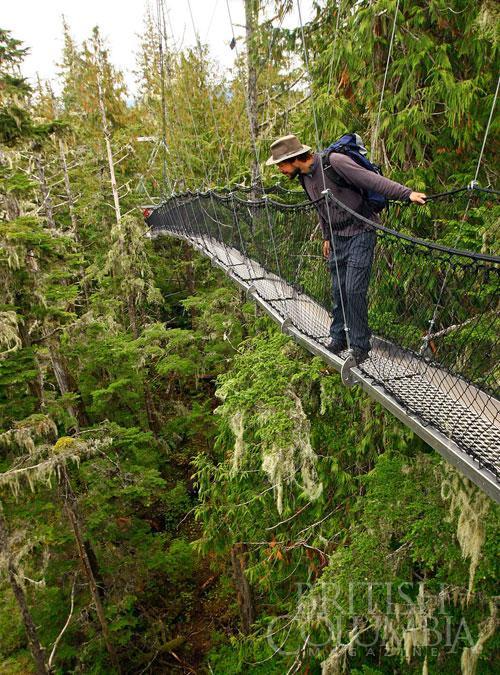 British Columbia Magazine
Location: Village of Metlakatla, Prince Rupert area (trailhead)
Date erected: Unknown
Status: Three engineered suspension bridges currently used by hikers
History: This trail has a short history as it was only opened in 2012. A community collaboration between multiple partners. The bridges were designed by John Helston who has designed comparable walkways in Nigerian mangroves habitats.
Use: Footbridge
Read more about this wilderness trail: trailpeak.com/trail-Metlakatla-Wilderness-Trail
Cal-Cheak
Location: Sea to Sky Trail, Brandywine Falls to Cheakamus
Date erected: Unknown
Status: In use
History: This suspension bridge was erected as part of the Sea to Sky Trail system. The bridge crosses Cheakamus River.
Use: Footbridge
